Client:
Build King-Samsung C&T Joint Venture
Build King-Samsung C&T Joint Venture link opens in a new tab
Project Owner:
Civil Engineering and Development Department, Hong Kong SAR Government
Civil Engineering and Development Department, Hong Kong SAR Government link opens in a new tab
https://www.tung-chung.hk/
Attention to Where It Matters
Attention to Where It Matters
Monitoring ground settlement using InSAR is a cost-effective method to monitor large, relatively remote sites. Sixense was brought in for one such use case at the newly-reclaimed Tung Chung New Town Extension. As the ground monitoring need focused on the long-term stability in the maintenance phase, our solution suits exceptionally well in this scenario.
The CEDD contract NL/2017/03 comprises the main reclamation work at Tung Chung East. Spanning 130Ha, the extension was commissioned to accommodate around 140,000 residents. Build King-Samsung C&T Joint-Venture began the construction works in 2017. Approximately five years later in late 2022, Sixense began monitoring the seawalls along the extension, when the construction phase was close to completion.
Start on the Right Foot
Tung Chung East was a milestone project for Sixense, as we prove our technical prowess and won the trust of the client in Hong Kong. Our remote solution saved numerous monitoring site visits, and reduced the risks associated with accessing the remote monitoring points.
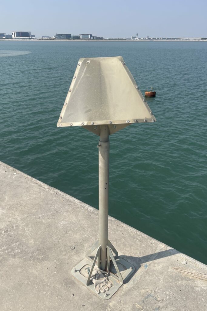
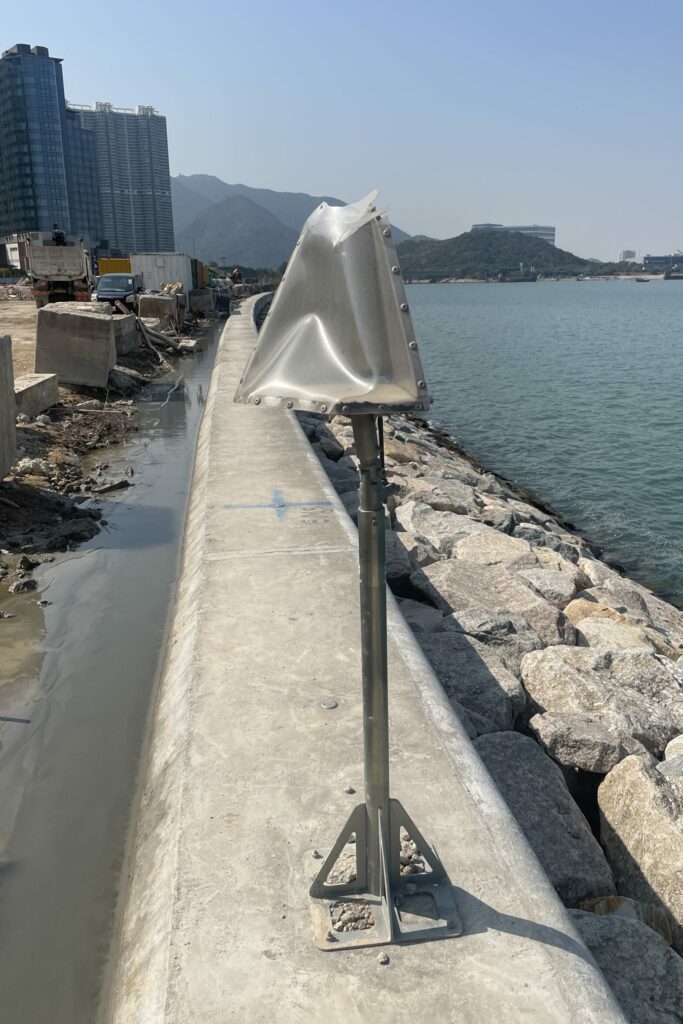
To secure reliable reflections at critical points, Artificial Corner Reflectors (ACRs) have been installed in designated points, obtaining a strong and constant signal in the chosen installation point. This network increases the density of measurements points in the sea wall, where the density of natural targets is scarce.
Marching Forward
During the monitoring period, Sixense provided quarterly updates to our client, utilising around 9 new images for every update.
To maintain optimal accuracy and data quality, Sixense has implemented a “sliding window” approach to this project. This method involves processing only the most recent 18-20 images (spanning roughly 7 months) at any given time. By focusing on this limited set of data, the method allows for continuous, accurate monitoring despite constant surface changes, ensuring reliable measurement points on the area of study.
Images of the project
Area of Interest (sq km)
Artificial Corner Reflectors
Measurement Points
Monitoring period (month)


